Directional Drilling Capabilities
 Download Case Studies
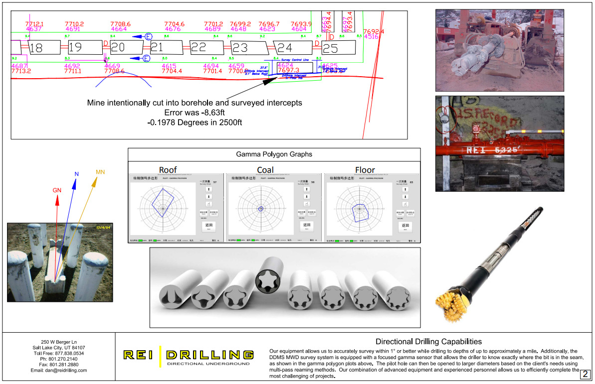
Our equipment allows us to accurately survey within 1” or better while drilling to depths of up to approximately a mile. Additionally, the DDMS MWD survey system is equipped with a focused gamma sensor that allows the driller to know exactly where the bit is in the seam, as shown in the gamma polygon plots above. The pilot hole can then be opened to larger diameters based on the client’s needs using multi-pass reaming methods. Our combination of advanced equipment and experienced personnel allows us to efficiently complete the most challenging of projects.
Directional Drilling Technology
 Download Case Studies
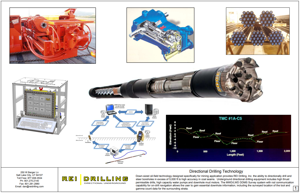
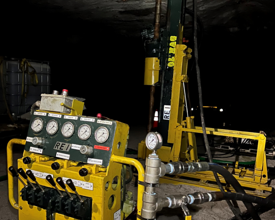
Underground directional drilling equipment includes high thrust permissible drills, high capacity water pumps and downhole mud motors. The MWD/LWD DDMS Survey system with rod communication capability for ondrill navigation allows the user to gain essential downhole information, including the surveyed location of the tool and gamma count data for the surrounding strata.
2 x Fletcher High Thrust Longhole Drills (2-part)
- > 40,000 lbf Thrust
- > 2,000 ft-lb Torque
- 5,000 ft, 3.8 inch diameter
- 3,000 ft, 6.0 inch diameter
- 4-4.5 ft H x 7-8 ft W x 16-18 ft L
- 480/575 VAC, 100 hp
3 x Fletcher High Thrust Longhole Drills (1-part)
- 50,000 lbf Thrust
- > 2,000 ft-lb Torque
- > 5,000 ft, 3.8 inch diameter
- > 3,000 ft, 6.0 inch diameter
- 4-4.5 ft H x 7-8 ft W x 16-18 ft L
- 480/575 VAC, 150 hp
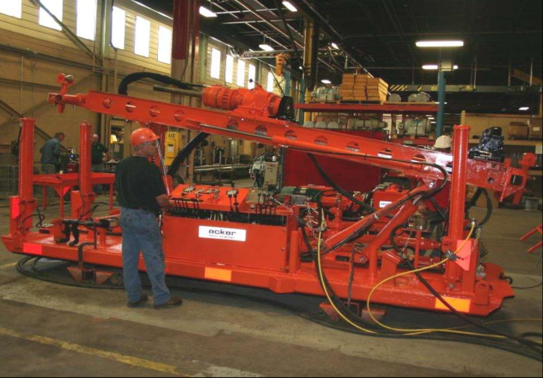
Acker Big John MPM Drill
- 30,000 lbf Thrust
- > 2,000 ft-lb Torque
- 3,000 ft, 3.8 inch diameter
- 2,000 ft, 6.0 inch diameter
- 3 ft H x 6 ft W x 18 ft L
- 480/575 VAC, 100 hp

2 x VLI 1000 Longhole Drills
- 50,000 lbf Thrust
- 3,000 ft-lb Torque
- 5,000 ft, 3.8 inch diameter
- 3,000 ft, 6.0 inch diameter
- 5 ft H x 6 ft W x 18 ft L
- 480/575 VAC, 120 hp
2 x VLI 3000 Extended Reach Drills
- > 125,000 lbf Thrust
- > 5,500 ft-lb Torque
- + 8,000 ft, 3.8 inch diameter
- + 5,000 ft, 6.0 inch diameter
- 7 ft H x 6 ft W x 18 ft L
- 950 VAC, 300 hp
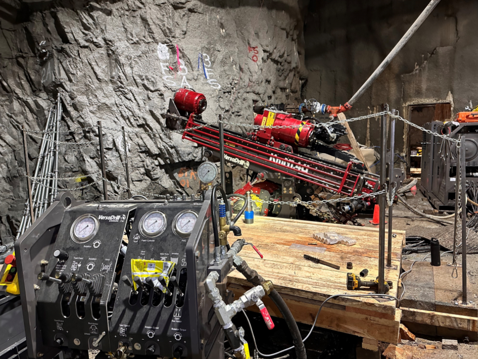
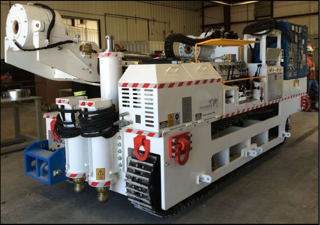
2 x Versadrill KmN1.4U Underground Drills
- > 25,000 lbf Thrust
- > 4,100 ft-lb Torque
- + 3,000 ft, 3.8 inch diameter
- + 1,500 ft, 6.0 inch diameter
- 6.5 ft H x 5 ft W x 13 ft L
- 480 VAC, 125 hp
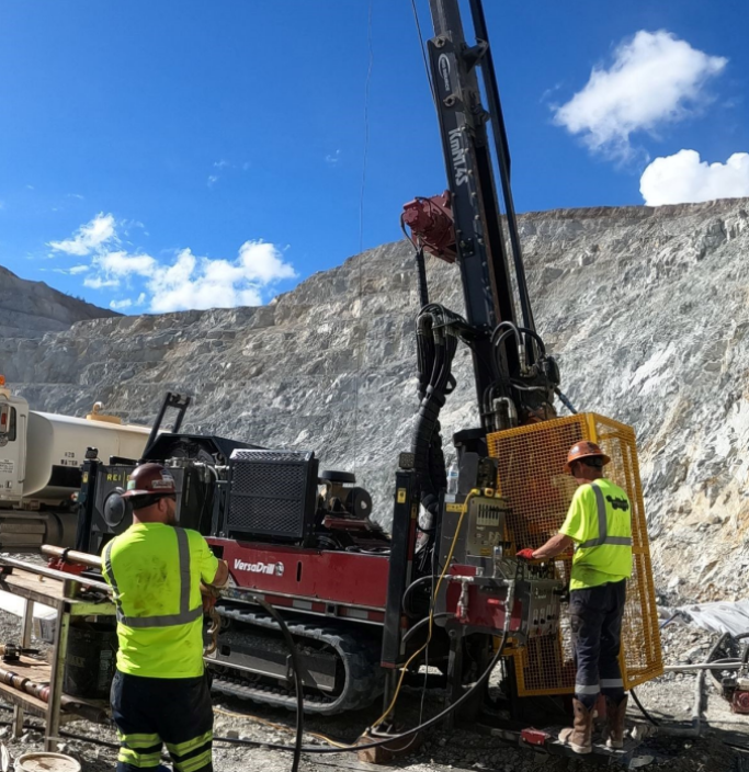
1 x Versadrill KmN1.4S Surface Drill
- > 38,000 lbf Thrust
- > 4,100 ft-lb Torque
- 4,000 ft, 3.8 inch diameter
- 2,000 ft, 6.0 inch diameter
- + 9 ft H x 7 ft W x 21.5 ft L
- 250 hp Tier 3 Diesel
1 x Hagby Onram 1000 Drill
- 15,000 lbf Thrust
- 1,400 ft-lb Torque
- + 2,000 ft, 3.8 inch diameter
- 3.5 ft H x 2 ft W x 10 ft L
- 480 VAC, 60 hp